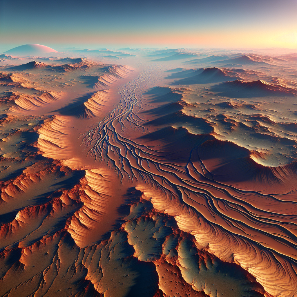
Mars, often envisioned as a barren, dusty planet, may have harbored an extensive network of river systems. Recently discovered ridges in the Noachis Terra region span over 15,000 kilometers, suggesting Mars was once warm and wet. This new evidence challenges existing theories of a cold, dry past for the Martian surface.
Unveiling Noachis Terra
The Noachis Terra region on Mars has long intrigued scientists due to its profound geological significance and rich planetary history. Spanning a vast portion of Mars’ southern hemisphere, Noachis Terra is characterized by its rugged terrain, ancient cratered surfaces, and evidence of past climatic conditions that have left an indelible mark on the landscape. This region, estimated to have been formed approximately 3.7 to 4.1 billion years ago during the Noachian epoch, stands as a testament to Mars’ dynamic geological past.
The geological significance of Noachis Terra lies in its extensive preservation of features from the Noachian era, a time believed to have had much higher levels of surface water activity compared to the current arid conditions. Researchers have been fascinated by the presence of heavily cratered landscapes which indicate an ancient and turbulent history. The region’s highland terrain and the presence of several large impact basins add another layer of complexity to its geological narrative. These features suggest that Noachis Terra has experienced significant geological and possibly hydrological processes over the eons.
To unlock the secrets held within this Martian landscape, scientists have employed a suite of sophisticated tools and methods. High-resolution orbital mapping and imaging have been instrumental in understanding the region’s geological intricacies. These techniques mainly involve the use of advanced cameras and spectrometers aboard orbiters circling Mars. Such instruments can capture detailed images of the Martian surface, allowing scientists to identify surface compositions, textures, and even minute morphological features.

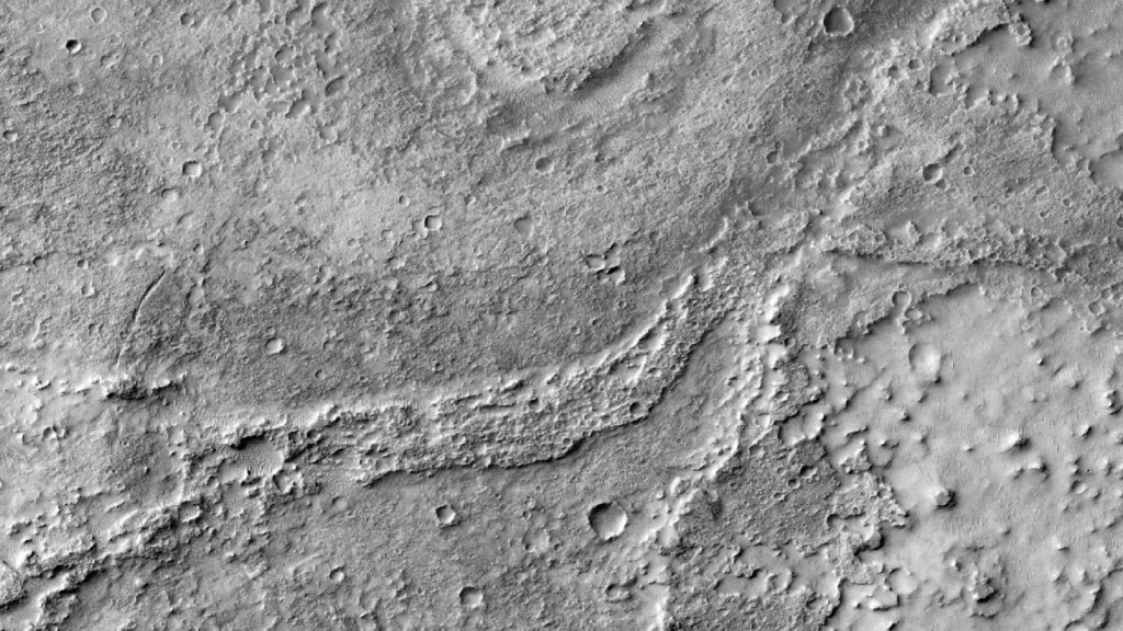
Credit: NASA/JPL/MSSS/The Murray Lab
The Mars Reconnaissance Orbiter (MRO) has played a critical role in exploring Noachis Terra. Its high-definition imaging system, the High Resolution Imaging Science Experiment (HiRISE), provides unprecedented views of the Martian surface. Coupled with the Compact Reconnaissance Imaging Spectrometer for Mars (CRISM), these instruments help determine the mineralogical composition of the region. Through these tools, researchers have been able to map out ancient river networks etched into the terrain with exceptional clarity.
One of the most exciting discoveries in Noachis Terra and similar regions is the identification of fluvial sinuous ridges, often referred to as inverted channels. These features provide crucial evidence of Mars’ wetter past and are typically formed when loose sediments are deposited by water flow. Over time, these sediments might become cemented by minerals, making them more resistant to erosion than the surrounding materials. Once the water is no longer present, wind erosion can remove the softer sediments surrounding these channels, leaving the more durable channel sediments elevated in the form of ridges.
These inverted channels are particularly significant because they suggest that Noachis Terra once experienced persistent and potentially substantial fluvial activity. The existence of such features requires a significant duration of liquid water flow, implying that the climate conditions during their formation allowed for sustained water bodies on the Martian surface. These channels, therefore, become vital pieces of the puzzle in understanding how Mars transitioned from a potentially habitable environment to the desolate world we see today.
The study of these features is further enhanced by digital elevation models (DEMs) created from stereo imaging methods. These models offer three-dimensional representations of the Martian landscape, allowing scientists to conduct detailed morphometric analyses. Such analyses provide insights into the past hydrodynamics that shaped the surface, including estimations of water volume and flow rates.
Researchers also utilize radar data from instruments like those on the Mars Express, which can penetrate the surface to identify subsurface geologic features. This radar data helps scientists discern the internal structure of the ridges and other buried channels, revealing additional aspects of the region’s fluvial history that are not apparent from surface data alone.
The presence of these ancient river networks in Noachis Terra challenges long-held perceptions of Mars as a cold and dry planet. Instead, it paints a narrative of a world that once supported conditions conducive to flowing water, albeit billions of years ago. Understanding the past climate of Mars is crucial for assessing its habitability and for future exploration missions that seek to understand whether life could have once persisted there.
As scientists continue to pore over data from Mars’ orbiters, each new revelation from Noachis Terra and regions like it brings us closer to piecing together the climatic mysteries of the Red Planet. This involves examining the complex interplay between geological formations and climatic shifts over time, providing a deeper glimpse into the environmental transformations Mars has undergone.
For aspiring space enthusiasts and researchers fascinated by planetary science, understanding the intricacies of Martian geology is just as exciting as it is important. Platforms like this site provide valuable resources and tools to aid in exploring such fascinating extraterrestrial phenomena.
This synthesis of geological and climatic evidence from regions like Noachis Terra continues to redefine our understanding of Mars, offering a tantalizing look at the planet’s past and reshaping what we know of our solar system. Engaging deeply with these findings not only enriches our view of Mars but also inspires future missions to explore these ancient terrains more intimately. As such, the tale of Noachis Terra is one of rediscovery and revelation, a small yet significant piece in the larger mosaic of Mars’ history.
Mars’ Wet Past Revealed
The revelation of ancient inverted river channels on Mars is redefining our understanding of the planet’s historical climate. These channels, long hidden beneath the surface, serve as palpable evidence of sustained water activity on Mars. They tell a story of a planet that once harbored aqueous systems, flowing with considerable persistence. The implications of this discovery for understanding Mars’ historical climate are profound. This newfound evidence challenges our previous models, which mostly painted Mars as a cold and dry world.
The detail that immediately stands out is the nature of inverted channels. Formed over millennia, these structures have withstood the relentless forces of erosion that stripped away the less durable materials around them. Their survival speaks volumes. It speaks of periods when liquid water, driven by gravity, carved its path across the Martian landscape. The inverted channels, therefore, serve as a robust testament to an era when Mars was a wetter and possibly warmer world.
The discovery of such features infuses a fresh perspective into Mars’ climate history. No longer can we view the planet solely as a barren, frozen desert. Instead, we are urged to consider that extensive precipitation and surface runoff might have been crucial components of its past. This significant nuance compels scientists to revisit and possibly revise established models of Mars’ climatic evolution.
The prevailing image of Mars has been one dominated by the vision of a frigid planet, wrapped in a thin atmosphere with sparse amounts of water locked in polar ice caps or diffused in the regolith. However, the channels suggest extended periods of more temperate climates where the water cycle was potent enough to create and sustain liquid flows. In this light, Mars was not just intermittently wet, but likely experienced long-term climate phases that allowed sustained aqueous activity.
Addressing the possibility of precipitation as a primary water source allows researchers to reassess past climate models. The idea of rain on Mars conjures imagery of an atmosphere dense enough to enable hydrological cycles reminiscent of Earth. This revelation has layered implications for our understanding of the Martian environment. It suggests not just transient weather systems, but stable periods of rainfall and runoff, hinting at an ancient climate system that could have supported life as we know it.
Mars’ wet history, newly illuminated by these channels, sets into motion a chain of speculations and questions. Where did the water originate? How sustainable were these wet periods? Could there have existed an interconnected network of rivers and lakes, akin to those on Earth? Envisioning Mars with such dynamic and long-lasting water systems demands a reevaluation of all geological evidence. For instance, sedimentary structures once considered negligible might now reveal critical insights about Mars’ water-driven processes.
Furthermore, the presence of inverted channels brings to attention the significance of erosion and sedimentation processes in Mars’ history. These activities, much like those that shape Earth’s landscapes, speak to the universality of geological forces across planets. An understanding of these processes on a celestial body without tectonics offers a unique angle on planetary evolution. How these channels withstood the test of time provides clues about the physical and chemical makeup of the Martian surface during periods of erosion and deposition.
Skeptical views of the robustness of Mars’ ancient hydrology are also put to the test. If Mars had sustained significant liquid activity, then the planet’s climate history cannot be solely defined by episodic outbursts tied to volcanic or impact-triggered melting. The evidence of prolonged fluvial processes suggests that other mechanisms, possibly even global climatic conditions, were at play. The channels drive a shift in focus towards exploring whether internal, geothermal heat sources or atmospheric changes could have facilitated more Earth-like conditions.
In juxtaposition with Earth’s river systems, the Martian channels raise intriguing comparative analyses. While Earth’s water cycles have been driven by tectonics and climatic consistency, Mars presents a case of dramatic shifts followed by stagnation. This comparison not only enhances our grasp of planetary climatology but also opens avenues for understanding planetary habitability.
Perhaps most intriguingly, the understanding gleaned from these ancient rivers might illuminate potential biosignatures. Where water flowed, life might have followed. By reassessing Mars’ historical climate, we inch closer to determining where and how microbial life might have existed. This discovery of invertible channels rekindles the quest for life on Mars. It makes the red planet’s climate history not just a matter of scientific curiosity but one intertwined with the ongoing search for extraterrestrial life.
The quest to unravel the true history of Mars’ climate is a pivotal part of our broader scientific understanding. A story told through channels that once cradled life-sustaining waters offers a narrative of Mars as a once-vibrant planet. The stakes are high, demanding the integration of data from various missions and advancing technology to see this story in its grand scope. Only by mapping and analyzing these channels through advanced imaging and spectroscopic methods can we refine our understanding of the Martian past.
Mars, long viewed as a static world, is revealed by these networks to have a history marked by dynamic environmental changes. As this data combines with current and future exploratory missions, what emerges is not just a planet of interest but a world ripe with history—one that continues to shape our understanding of both planetary science and the possibilities for life beyond Earth.
For those with a keen interest in these planetary dynamics, looking at how Mars’ climate aligns with our understanding of planetary formation illuminates core questions in astrogeology. One might find insights echoing through comparative studies of Earth’s past climates and potential similar processes on Mars, thereby providing broader lessons applicable to bodies in our solar system and beyond. To explore these scientific endeavors further, consider delving into resources that focus on the life cycle of celestial bodies, such as this engaging look at the life cycle of stars, which broadens the context of these interplanetary studies.
Scientific and Exploration Impacts
The discovery of ancient river networks on Mars has marked a transformative moment for science and exploration. These findings have reshaped our understanding of Mars, offering fresh insights into its past climate. Alongside this, they have provided new directions for future missions to the Red Planet. The implications are vast and compel both scientists and exploration advocates to reassess strategies, tools, and objectives.
**Current Scientific Understanding**
The river networks discovered on Mars bolster the evidence of a wetter climate in its ancient past. Scientific consensus now shifts, suggesting Mars possessed surface water bodies much more significant than previously thought. These findings contradict the long-standing view of Mars as a primarily cold and arid planet. By understanding the planet’s past hydrology, researchers can draw parallels to Earth, studying phenomena like the hydrological cycle’s role in shaping planetary environments.
Besides climate reconstruction, the discovery informs geophysical and geochemical analyses. Mars’ ancient water channels indicate substantial erosion and sediment deposition, revealing past geological processes. These erosive forces could have shaped the Martian landscape dramatically, explaining formations like valleys and basins. The future of Martian geology lies in examining these networks for clues about the planet’s tectonic and volcanic history.
**Research Tools: Pivotal Roles**
The uncovering of these river networks wouldn’t have been possible without sophisticated research tools. The Context Camera (CTX), the Mars Orbiter Laser Altimeter (MOLA), and the High-Resolution Imaging Science Experiment (HiRISE) have been instrumental in this breakthrough.
– **CTX and HiRISE**: These provide detailed images of the Martian surface. CTX’s broad mapping capabilities, combined with HiRISE’s exceptional detail, allow scientists to identify and analyze riverbeds with precision. The images reveal complex channel systems, maintaining intricate details of river valleys.
– **MOLA**: This tool has offered crucial topographical data, mapping Mars’ elevation changes. By determining elevation profiles, MOLA helps identify water flow directions and potential ancient water bodies. The laser altimetry data enables high-resolution terrain models, crucial for understanding Martian hydrology and geology.
Interpreting these datasets has revolutionized our perspective on Mars’ environment, shaping ongoing debates in planetary science. Scientists can now simulate past watery landscapes, estimating erosion rates and sediment transport. Such models offer a more vivid picture of Mars’ transformation over billions of years.
**Future Mars Exploration Missions**
With the new evidence of ancient river networks, exploration missions must recalibrate their objectives. Recognizing previous water presence raises the likelihood of discovering past life or biochemical processes on Mars. Missions now have an added focus on these sites, targeted by upcoming rovers and landers.
Ancient riverbeds become prime candidates for searching for signs of life, both past and potential presently persistent microenvironments. Future exploration could involve drilling into riverbeds, aiming to collect subsurface samples. These samples might preserve organic compounds, offering pivotal clues about Mars’ potential to harbor life.
Additionally, selecting landing sites for these missions hinges upon understanding Mars’ ancient hydrology. The new discoveries provide valuable criteria for choosing landing zones, prioritizing regions with water-altered minerals or delta formations. By focusing on these key areas, missions maximize their scientific yield, increasing the likelihood of groundbreaking discoveries.
**Implications for Habitability**
The presence of ancient rivers also impacts the discourse on Mars’ habitability. Mars’ ancient wet periods hint at prolonged conditions conducive to life. Recognizing large bodies of stable liquid water reshapes the search for past Martian life. It suggests habitable zones may have existed far more extensively across the planet than previously considered.
Water’s role as a life enabler cannot be overstated. The identification of geological features formed in these ancient water-rich periods strengthens the hypothesis that Mars possessed, at times, a supportive environment for life.
**The Encouragement of Continued Exploration**
As this chapter of Mars exploration unfolds, it emphasizes the need for continued research. Advances in technology will enable even more detailed and extensive studies of Martian topography and geology. Upcoming missions focusing on these ancient channels must leverage the technological tools available, with precision instruments and innovative methodologies.
Inspiring a new generation of scientists and explorers becomes paramount. The boundaries of what can be known about Mars are continually expanding, offering numerous opportunities for breakthroughs. By championing a culture of curiosity and innovation, future missions can target these river networks, slowly unraveling the mysterious history of Mars.
Technological progress further enriches the exploration agenda. As high-resolution imaging and remote sensing evolve, our ability to decode Mars’ past becomes increasingly sophisticated. Exploration missions may soon employ artificial intelligence to process and interpret voluminous data efficiently, identifying potential sites of interest with minimal human intervention.
**Stay Informed and Engaged**
These findings encourage a broader engagement with the Martian exploration narrative. Staying up-to-date with ongoing research, advancements in exploratory technology, and upcoming missions ensures a more informed public and scientific community. Engage with resources offering insights into the dynamic world of Martian research. Visit contexts that delve into the implications of these discoveries to understand how they fit into the larger puzzle of planetology.
With every technological and scientific advancement, we open new windows into Mars’ past, providing tools to explore its mysteries. By continuing to support and engage with Mars exploration, we contribute to a profound journey of discovery that urges us to redefine our understanding of the cosmos. To remain well-informed about the latest developments in Mars exploration, consider visiting relevant resources and become an active participant in humanity’s story of exploration.
Final words
The discovery of ancient river networks on Mars fundamentally shifts our understanding of the planet, indicating a once warm and wet environment. Such evidence highlights the complexity of Mars’ past, paving the way for future discoveries and exploration. Continued research could unlock more about Mars’ climate history and potential for past life.


